![]()
Celebrations of Life Friends & Family Home page
Hurricane Chronicles Living Aboard The Boat
![]()
![]()

![]()
The Little Shark River
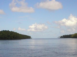
(aka "September Sea's Hurricane Hole")
The black line above the number 30 is the entrance to Little Shark River.
|
Hello my Darling Krista!
We are leaving this afternoon to go scope out our "Hurricane
Hole." You can find it on the internet, so you can see it
for yourself. It's called "Little Shark River."
It really is much more like creeks in the midwest. Very
overgrown with mangroves all around you and a very narrow water
passage. It will make the perfect place to hunker down, rope the
boat every which way but loose to the trees, and ride out the fury!
Now get this! The area of "Little Shark River" which
we will be, will be very far up into the river. The river forks
off many times to reveal small lakes inside. These lake areas
are completely surrounded by mangroves, with the exception of the
small inlet used to get inside of it. However, it is MOSQUITO
HELL. Supposedly, the mosquitoes there are ruthless!
Go do a search on "Little Shark River" on the internet and
you will find that one of the first listings is a story a guy wrote
that he says is supposed to be fiction.... well, OMG! Read it,
Krista... you'll want me to have my head examined... and QUICK!
Wait,here's the link. Once there, just click on "Little
Shark River."
http://www.weekendcruiser.com/old_salt_little_shark_river.htm
We our going on our expedition with another boat, a couple we have met
down here who are just wonderful. So our two boats will go
together and there is always more safety in numbers. If we get
stuck, they can tow us out, and vice versa.
We have armed ourselves with 100% Deet insect repellents. We
have clothes that are made to protect us from insects... long sleeves,
vented backs, socks, shoes, Australian hats that cover our ears and
necks... Girl, I must be outta my mind!
Well, we'll see if its all worth it. Looking on the charts, it
appears that it will be. Going there and conquering those
critters without a hurricane up my butt is one thing; doing it to
scout it all out is another! ha!
I do think I'll LIVE through it... but I tell ya, we are living the
life of adventure, that's for damn sure!
Kisses and hugs to all. I know the boys will enjoy their trip
today. TOP GUN was one of my favorites too! Tell em I'm
jealous and wish I were there too!
Love you to pieces... We'll return to our Marina slip next
Wednesday... wish us luck!
Charmaine & Bill Aboard s/v September Sea |
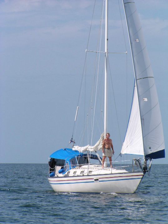
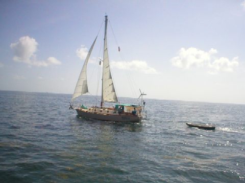
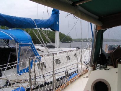
Sailing from Marathon to Little Shark River... time to anchor outside the entrance.
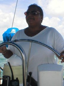
Below, Charmaine at the helm.
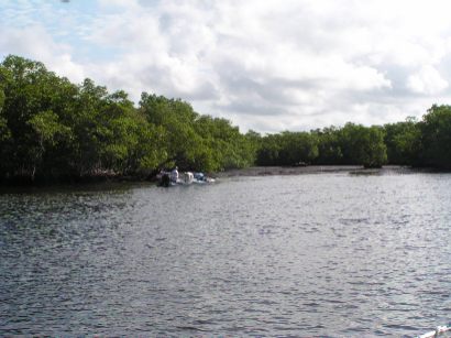
Kathleen and Jim, our trusty mates, came along with us on their s/v Drummer with dinghy Bongo trailing behind.
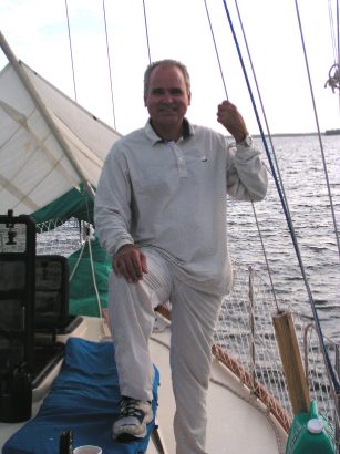
"Eagle Scout" Jim. He and wife Kathleen are just like family members to us. If we had to pick sailors to have along with us whenever things got scary, it would definitely be Kathleen and Jim, hands down.
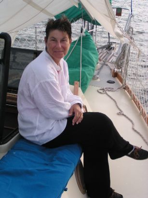
Rafted up with s/v Drummer for a lunch break. Kathleen made "Shrimp and Rice Salad ala Charmaine." It was absolutely delicious! She took all the things I love: olives, shrimp, eggs, rice, cheese... and made it into a wonderful cold salad that was scrumpdillyicious! We make it often even now. Sure do miss our mates, Jim and Kathleen (aka "Eagle Scout" and "Leen), Charmaine's affectionate nicknames for them). They were our next-slip neighbors at Dockside in Marathon. The couple always busy modifying and improving their beautiful steel sailboat, Drummer (and their dinghy Bongo). I just love those names. They went cruising as of 2004 and as of March 2005 they are volunteering their services to the Ivan clean-up in Grenada. Two fantastic, loving people. Truly like family to us. Can't wait to join them someday soon!
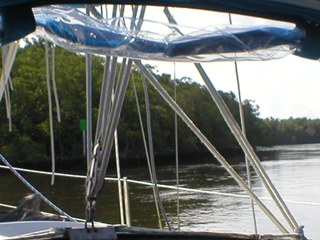
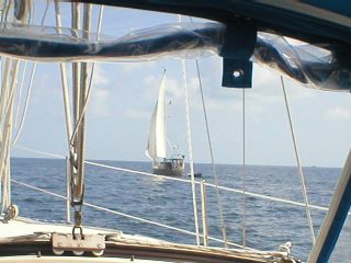
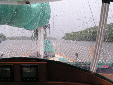
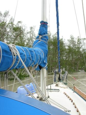
Looking through the dodger of s/v September Sea.
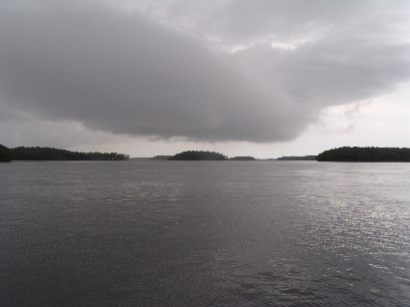
Sudden squall approaches us in the Little Shark River.
Below: Rain falls on s/v Drummer.
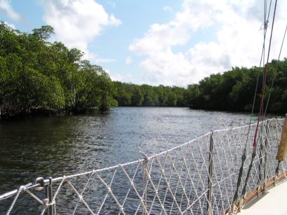
We explored as much of the Little Shark as possible. Jim and Bill would get in Bongo and go do depth soundings in areas we were unsure of. We'd mark on our chart notes of shallower spots and silted in areas to steer clear of (like the formerly unmarked funky little spot ran aground on!). This entire trip would be very important come time for us to escape here for protection from hurricanes. The 2004 Hurricane Season proved we had done just the right thing by coming here a year earlier. We went to Little Shark for both Hurricanes Charley and Ivan. We knew right where to go and were nestled in beautifully! Safe and sound!
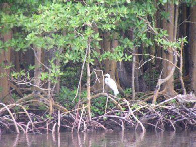
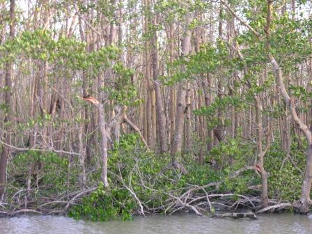
Little
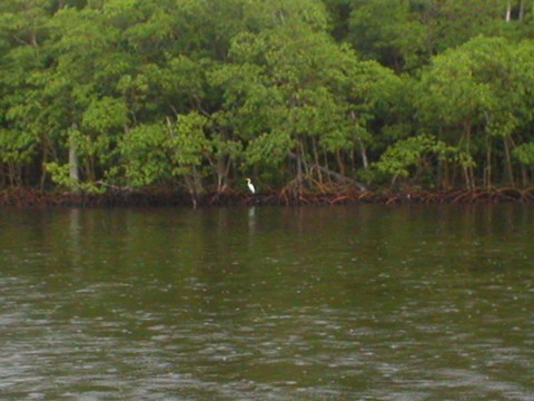
Shark River is abundant with wildlife.
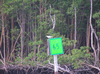
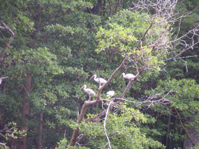
Cattle egrets and herons throughout the mangroves.
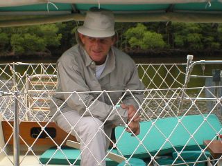
Bill is all geared up for exploration. Lots of great fishing at Little Shark.
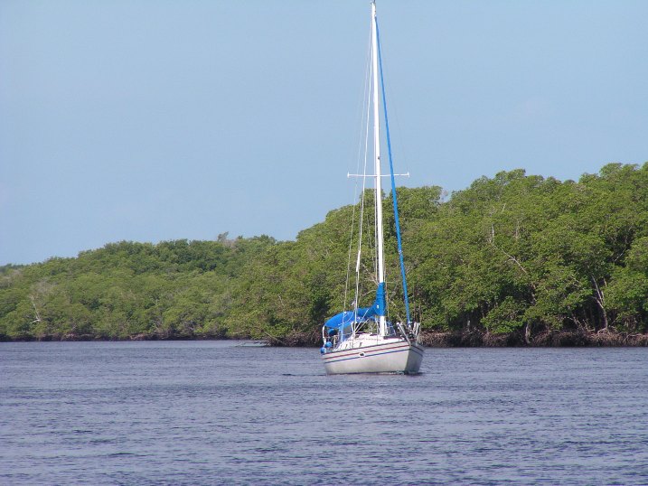
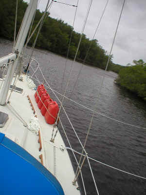
September Sea explores the Little Shark River.
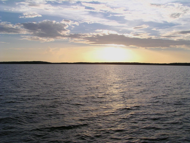
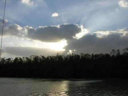
Beautiful sunset at the Little Shark River.
Kathleen is "all in" at the
end of a long day. 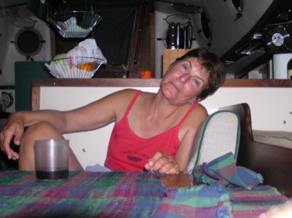
Little Shark River satellite map.
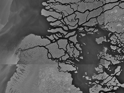
The first entrance on the far left is the entrance into the Little Shark River. From the south, you would enter by turning east past the Green markers. You'll then enter a big horseshoe shaped area (you can actually see the shape on the satellite map) where many boats anchor when exploring the Little Shark River. It's breezy there and lots of room.
Details: Getting to Little Shark River from the Keys.
Tied up Super Snug for Hurricane Charley.
Tied up for Hurricane Wilma.. we've already endured lots of surge and wind. You can see the 15 foot surge in Little Shark River. Normally you should be seeing land where the mangrove are. LOTS of land.
Inside the Little Shark River we had survived Wilma and her 120 knot winds. September Sea was unharmed. The mangroves saved us as we were nestled in a canal quite a bit wider than we like, but it served us well. The mangroves were tall and lush when we entered. Our boat never touched the mangroves, as we are in the middle of the canal... but the wind blew all their leaves off and mangled much of them severely. Before Wilma this shot would have been a wall of lush foliage, AFTER Wilma (compare it to the lushness in the picture above when we were tied up for Charley). Devastation:
But there were NO man-made objects to harm us. Only the mangroves which did their best to protect us. It was amazing watching all the wildlife coming back to life after Wilma. Bill and I were up on deck watching the incredible sunset (below). As I sat there with my Diet Pepsi in my hand... the tiniest green hummingbird came and drank from the rim of my Pepsi. It was the most incredible moment. Mr. Hummingbird was obviously very thirsty and glad to be alive. We hardly got any rain with Wilma, she just blew seawater all over the place. The hummingbird attested to that fact. He was glad to see me and showed no fear of me at all. And quite honestly, I sure was glad to see him too.
You know, if little green men from outer space came and attacked us all, like "War of the Worlds," suddenly there would be absolutely no separation of humans on this earth -- we would truly be all the same: US against THEM. No matter what social or economic class, race, religion, nationality, or creed... we would be ONE in the fight for survival as ONE RACE: the HUMAN RACE. No more jokes about the French, please. We are all sisters and brothers on this planet. See what a few hurricanes will do to a person? Fortunately, I have always been this way... my love for all mankind; it's just that normally I stay off soapboxes!
Sunset in Little Shark River immediately after Hurricane Wilma. That night the stars were so bright and Venus was sparkling with a glow all around her. It was as if God Almighty was saying, "Here's your reward." I don't believe God makes these things happen, I believe WE as human beings are building in areas where hurricanes blow. We don't have to be there... do we? That includes me. We have brains to get out of harm's way... and we also have the sense enough to know when it's time to move out of the hurricane belt. It took us four years to realize running from hurricanes for six out of twelve months is not really the type of adventurous lifestyle we we hand in mind! LOL Though it was fun, I will admit. Prepares us for just about anything... but we've had enough experience with hurricanes to last us our lifetimes. Perhaps in ten years or so when Florida and the Keys aren't getting hammered... we'll make our way back to stay in the Keys again. DOUBT IT.
Four major hurricanes in the span of six weeks in 2004. Incredible! Then 2005 came along and it was an even more active and horrific hurricane season. Made 2006 look like a walk in the park. Absolutely unbelievable.
You can read about our experiences in "THE HURRICANE CHRONICLES:"
(The Madness of 2004 - The Horrors of 2005 - The Wimps of 2006) or just...
![]()
The excerpt below is a reprint from Gregory T. Absten's Boot Key Harbor website. Gregory's website is an excellent resource for anyone planning to cruise to the only real weather-safe Harbor in the Keys: Boot Key Harbor in Marathon. The Messageboard at Gregory's site is also very useful in contacting others in the area to ask questions or find "Local" knowledge. Always a plus!! Thanks for all you do, Gregory!
|
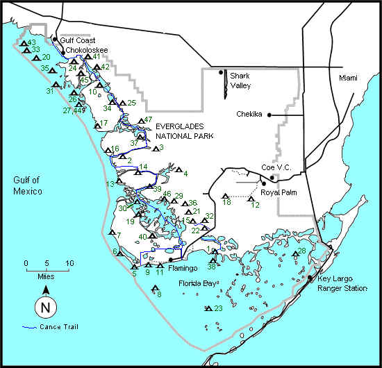
Cruisers Information for Little Shark River / Tarpon Bay: This is so far into the everglades that nothing works - phones or TV (Satellite is OK). VHF will still reach to Flamingo. Remember a Florida fishing license if you’re catfishing. You'll be anchoring - there are no facilities. A dinghy is very useful, but someone can shuttle you between boats if you don’t have one and you go with a group. There are no facilities and no docks. Be self sufficient. Some of us raft up in 3-4 boat rafts depending on size of boats and weather. Always be prepared to break a raft - even at night - in case the weather gets bad in order to prevent the raft from breaking loose and drifting. If it does get stormy then a posted watch isn’t a bad idea. Holding is generally good in the bay, but there are some boulders/rocks reported. A trip line on the crown of your anchor would make retrieval easier if it gets stuck - though we try to avoid this here (if it gets caught in the props during a swing, I don't want to swim under the boat to cut it out!). The Bay is generally calm. There are fishing boats around during the daytime, and some primitive campsites scattered here and there. DO NOT SWIM IN THE BAY - because of Alligators. Crabbing and Catfishing are excellent. Mosquitos should be under reasonable control in February, but bring bug spray and whatever "after-bite" itch remedy you like. Many people talk about "skin so soft" being a good repellant besides bug spray. (Go inside at dusk for a while) They usually come out at dusk for an hour or two, then we can come back out if you don't turn on lights. Light colors of clothing are suggested to minimize the attraction to mosquitoes. In the winter (usually when we go because the bugs are too bad in the summer) it can get cool at night, so bring a jacket, socks and some warm clothing. Activity: . You can catch freshwater catfish and crabs for a group feast. Gunkholing is good in dinghies and you should go on a dinghy expedition. There are tons of creeks and rivers up there to explore from Tarpon Bay including the Alligator pond up Avacodo Creek (Canepatch primitive campsite), the Harney & N. Harney Rivers, plus the entire Wilderness Waterway routes. Bring cameras for the alligators & eagles. Handheld radios are worthwhile for safety to stay in touch with the motherships. A handheld GPS, though not necessary, is convenient from the dinghy. Charts: The Little Shark River chart is #39 Waterproof Chart or #11432-1 Shark Rvr to Lostmans Rvr gov’t chart. 11433A Everglades National Park provides more detail to the entrance of the Little Shark River and part way up. Marathon area is #11451 (make sure it’s Nov 22, 97 or later, since the daymarks changed). #11433 covers the waters off Cape Sable, and # 11450 is the entire area from the Keys to Little Shark River. Chart Printout: Though the actual charts will give you
more detail, here are a couple scanned portions to give you an idea of
the route. Click on the links, then printout if you want. Satellite
pictures are great too. Navigation from Marathon: Once you clear the shoals around
Marathon (John Sawyer bank is last one if leaving from Fanny Keys), we
head up to just west of Cape Sable. The heading from just off Fanny Keys
is roughly 351 magnetic. It's 37 nm from the North side of Marathon to
the Entrance of the Little Shark River. This first waypoint off Cape
Sable will be about |
